

The Rock, town and the Neutral Ground (see LINK) from the air - a contemporary view


Nissen huts on the west side of the Alameda Estate
In the late 1950s my family were moved from Main Street to 45 Alameda House, Red Sands Road in the newly built Humphreys Estate. Great for us but I remember that there were still people living in cramped conditions in Nissen huts all along both sides of the estate. The ones shown on the second photo were known collectively as “la Batería” as the huts had been erected on Jumpers Bastion. (See LINK)

Red Sands Road
The Fire Brigade were housed in the white building in the distance with a mast. Alameda House, Red Sands was just to the left of it and does not appear on the photo which faces north. I can hardly remember ever taking this road. If I wanted to go to the south - which was hardly ever - I would take the Europa Road which was further up the Rock and to the right.

Alameda estate "modern" kitchen
I can’t remember it being like this - but it must have.

The annual Fair
For several years during the 1950s it was held in the parade ground/car park just below my house in Red Sands Road - For an entire week it was impossible to get a good night’s sleep.

Inside the Rock
I am sad to admit that I have never visited any of those many tunnels and military constructs inside the Rock - not even the famous Galleries (see LINK) beloved of today’s tourists. They were out of bounds to ordinary civilians when I lived in Gibraltar.

Gibraltar Gharry
There were plenty of these still around when I left the Rock in the 60’s - but I must admit that I personally have never been on one. Gibraltar’s most well know Gharry driver - a Mr. Martinez who was universally referred to as Bishua (Besure?) - was before my time.

Glacis Estate
During my stay in Gibraltar I never visited this part of the Rock - probably because none of my school friends lived there. What I do remember is that Nissen huts proliferated in this area - and for the reasons already mentioned above.

Calpe Road
The apartment buildings are on Calpe Road. The two soldiers were probably local members of the Gibraltar Defence Force - I did my national service in the GDF - or haciendo el Gee-dee-eff - which is what we all called it.
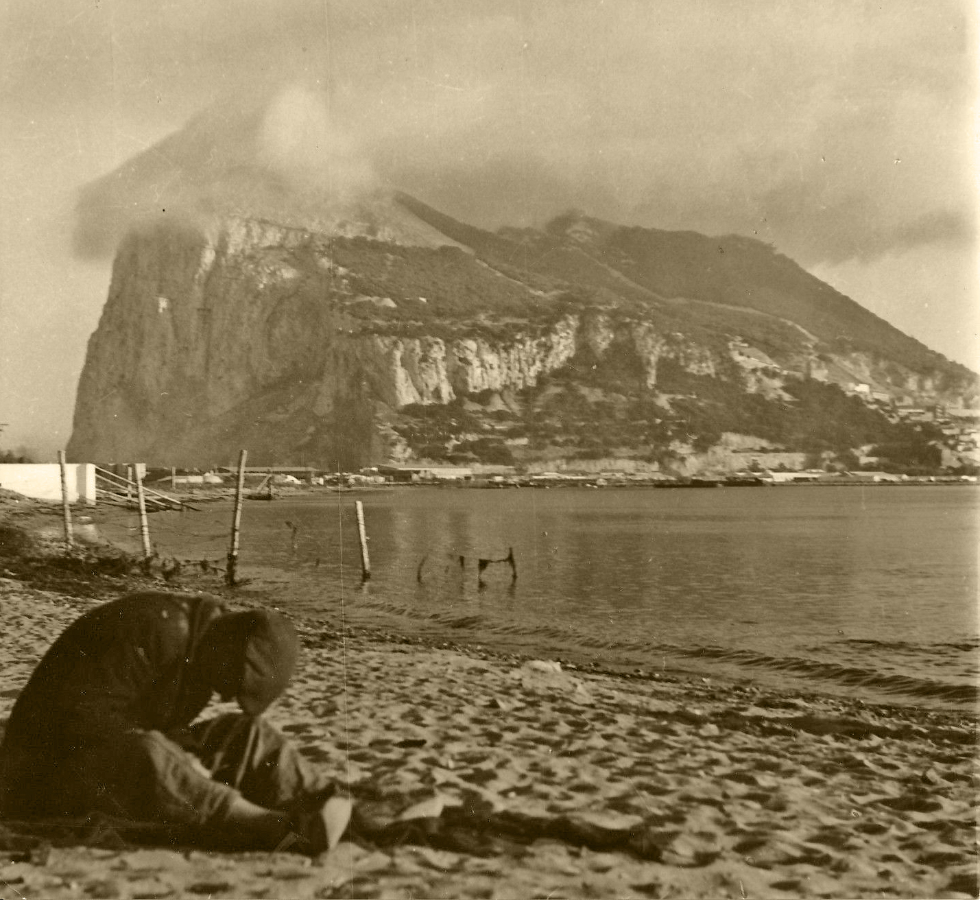

The Rock from a western beach in La Linea
I would imagine that both photos were taken on the same from slightly different places in Linea - the Spanish frontier town with Gibraltar. The cloud above the Rock in the first photo is the result of moisture laden air hitting the eastern cliffs of the Rock. Rapid condensation leads to the formation of a phenomenon known as the "levante". I can’t remember ever having frequented any of the beaches on the west side - either Spanish or Gibraltarian.

South District


The church in the first photo is St Josephs’ - I have never seen it neither outside nor in. The same goes for both South Barracks and Bleak House. I had never even heard of them.

King George V Hospital
There was something of a tuberculosis epidemic i Gibraltar during the 1950s and several of children from my school were affected. They were taken to this hospital - known locally as the KGV. I can’t remember ever having been inside visiting.
1950s - Gibraltar - Rose-tinted Snapshots - 1
1950s - Gibraltar - Rose-tinted Snapshots - 3